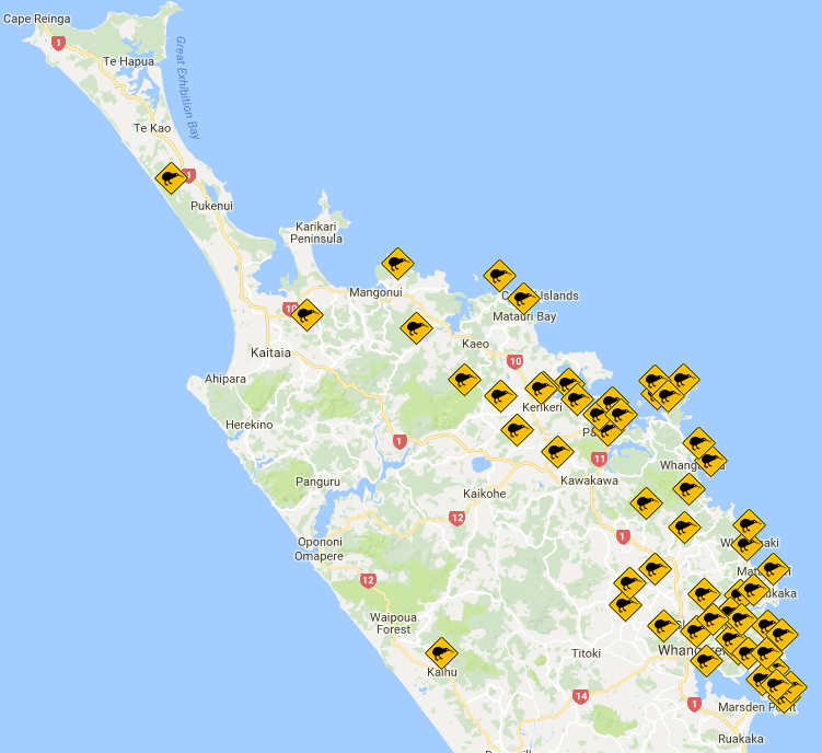
The Kiwi Coast is now stronger than ever with 71 groups, projects and organisations collectively managing 120,293 ha.
 A further 11 groups have joined the Kiwi Coast over the last year, taking the total number of projects and organisations involved to 71. This means that the number of groups participating in the Kiwi Coast has more than doubled since it got underway in 2014.
With the recent addition of Mangatete Landcare and the Far North Sports Shooting Club, the Kiwi Coast now extends approximately 195km from Bream Head to mid-way up the Aupouri peninsula in the Far North.
View the Kiwi Coast Groups Map
GIS analysis by the Northland Regional Council reveals that together Kiwi Coast groups actively manage 120,293ha.
While the Kiwi Coast has a strategic focus on predator control and kiwi recovery, the individual projects and groups involved carry out a vast array of biodiversity restoration activities including animal and plant pest control, education and advocacy, wetland and riparian fencing and planting, threatened species translocation and habitat restoration. While the vision of a thriving kiwi corridor links each project together, no single project focuses solely on predator control for kiwi recovery.
Defined by the groups and projects linked into it, the Kiwi Coast is growing organically into a multi-faceted ecological corridor with kiwi leading the charge as the iconic flag bearer.
To find out how to link your project into the Kiwi Coast or start your own community group contact Ngaire Tyson, the Kiwi Coast Coordinator.


